Radiosonde (Weather Balloon) Email Notifier
Sign up here to receive email notifications when a radiosonde lands near you!
Not many radiosondes land near my home town of Seattle. The weather balloons launched from Quillayute, about 100 miles (170km) west, usually land somewhere inaccessible such as in the Olympic forest or the ocean. Only rarely do they come far enough east to land in civilization. My habit was to check SondeHub to see if the day’s flights landed nearby. This was an annoying chore, so I set up a system that would query SondeHub’s API for me and send an email if a radiosonde landed less than a configured distance from home. This facility is now available to anyone!
Notifications are configured with:
- The latitude and longitude of “home”
- The maximum distance from home for a landing to be interesting
My system checks SondeHub regularly. Any landings within the desired search area are reported. You’ll get email with a table showing the important statistics, like this example:
| Sonde ID | V1914106 |
| Last Reception | |
|---|---|
| Heard | 2023-11-15 05:01:16 PST by KK6HMI-2 |
| Altitude | 3,794 ft |
| Position | 47.8959, -123.07148 |
| Address | Clallam County Clallam County, Washington, United States |
| Distance | 39 miles from home |
| Bearing | 297° from home |
| Descent Rate | 40 ft/s, moving laterally 5 ft/s, heading 324° |
| Landing Estimation | |
| Ground Elev | 3,481 ft |
| Time to landing | 8 s |
| Search Radius | 35 ft |
The time of day will be reported in the time zone of the computer used to sign up for notifications. The distance and altitude units can be configured to be metric or imperial.
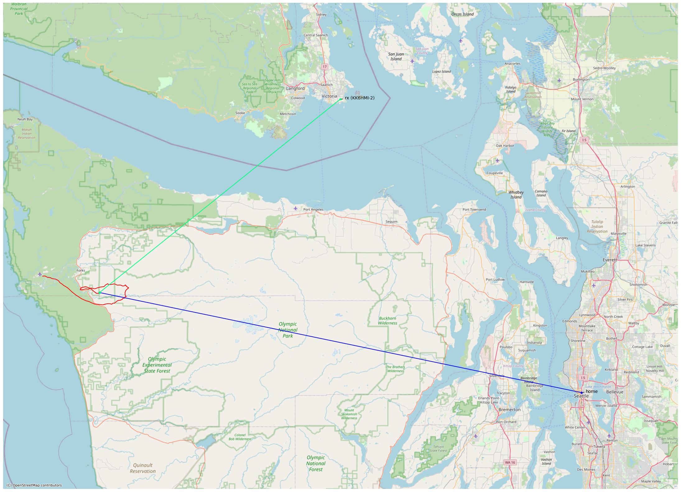
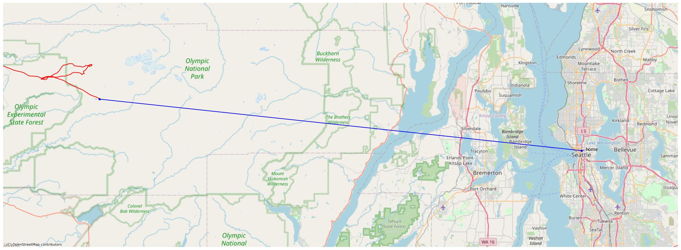
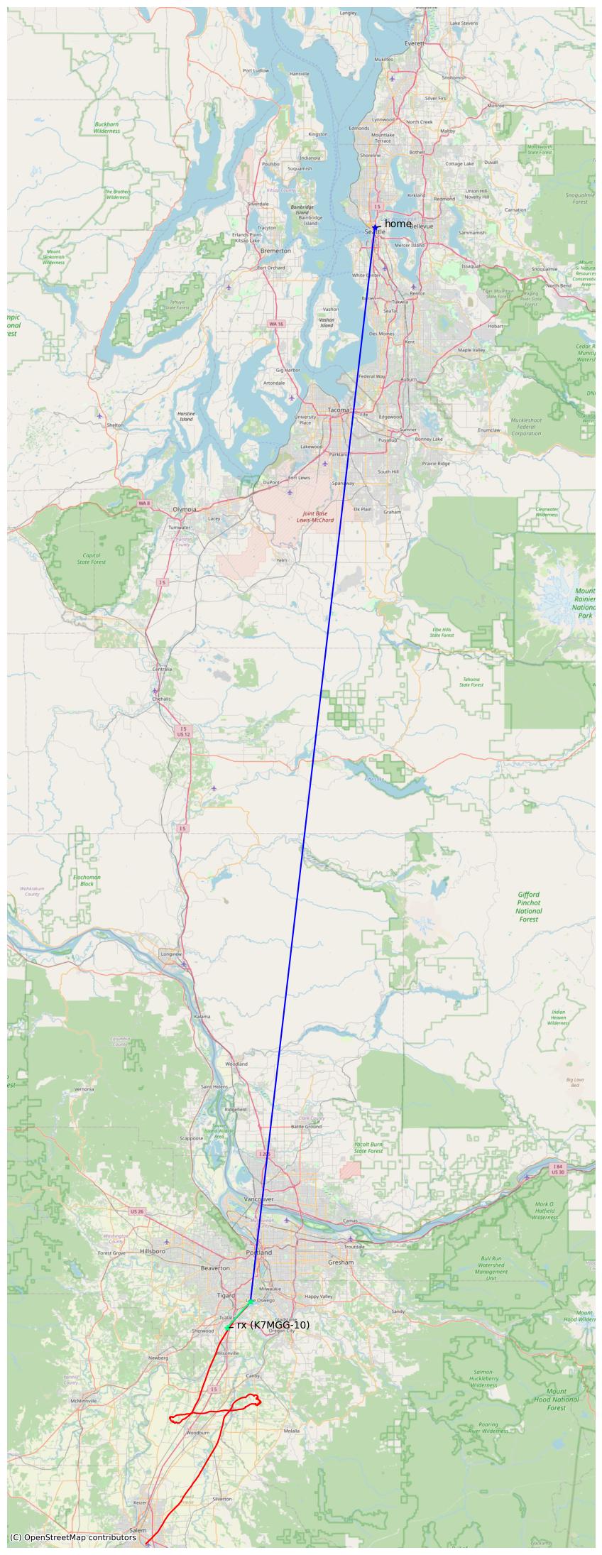
Notifications have a map attached showing where the sonde was last heard by a receiver. It plots the sonde’s flight path (red), a line from your configured home coordinates to the last reception (blue) and a line from the last receiver site to the sonde (green).

Accuracy
A sonde’s mapped location is usually not where it landed, but where the sonde was last heard by a receiver. The actual landing site might be some distance away. Click on the sonde’s serial number at the top of the table to see SondeHub’s projected landing site based on a model of winds aloft and terrain.
Sondes last heard at high altitudes depend more heavily on these models, increasing the potential for error. The notifier guesses the error of the landing estimate by estimating how far the sonde was traveled laterally before reaching the ground from its last known location. For example, if a sonde is last heard at 1000’ MSL above 200’ high terrain while descending at 100’ per second, it’s about 8 seconds from landing. Multiplying 8 seconds by its horizontal speed gives a rough upper bound on how far the actual landing site is from the last-heard location.
Of course, this algorithm is fairly naive compared to SondeHub’s more sophisticated terrain and wind model. However, the rough error estimate helps you decide if it’s worth the time to investigate the flight further as a potential find.
The quality of the tracking depends largely on how many volunteer receive sites are nearby and the terrain or other obstructions (e.g., buildings) between the sonde and nearby receivers. The more receivers there are in strategic locations, the more likely it is that sondes will get tracked to lower altitudes. If you want better tracking, the best way is to set up your own receive site!
Ground Receptions
Occasionally, if you’re very lucky, a sonde will be within earshot of a receiver all the way to the ground! This is an exciting situation because it means there’s far less error in the sonde’s location. Since we’ve gotten its GPS coordinates while it was sitting on the ground, we know almost exactly where it is—we can just go pick it up!
The notifier detects ground receptions when the last data points reported by a receive site indicate the sonde’s vertical and horizontal velocities are both close to zero. In this case, the notifier will send an email whose subject excitedly proclaims “GROUND RECEPTION!”.
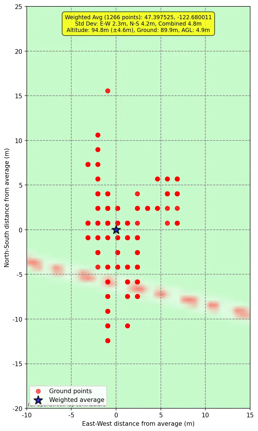
Sondes keep transmitting for many hours after they land. If we’re lucky enough to hear a sonde while it’s on the ground, we can estimate the its final resting position even more precisely by averaging all the post-landing frames overheard. The notifier does this automatically. Ground reception emails tell you the number of ground-transmitted frames received, the average lat/lon and elevation of those frames, and the position’s estimated error (standard deviation). Here’s an example from sonde X0933436, from which we heard over a thousand frames while it sitting on the ground:
| Ground Reception | |
|---|---|
| Ground Points | 1266 frames |
| Avg Position | 47.397525, -122.680011 (±16') |
| Avg Altitude | 311' (±9') |
| Est. Height | 15' AGL |
The notification also includes a special map showing all the GPS positions reported while on the ground.
Notification History
The management page lists all of the notifications you’ve received in the past 30 days. For each sonde that landed nearby, you’ll see the date and time of the sonde’s final reception, the sonde’s serial number, a link to SondeHub’s page, and the map attached to the notification. Here’s an example:
| Sonde Last Heard | Dist from Home | Sonde ID | Map |
|---|---|---|---|
| 12/23/2023, 4:57:08 PM | 94.2 mi | V1750589 | Map |
| 12/23/2023, 5:03:06 AM | 71 mi | V1750579 | Map |
| 12/22/2023, 5:29:15 AM | 152.6 mi | V4030234 | Map |
Signing Up for Notifications
Sign up here to receive notifications!
The notification service is free. We won’t spam you or send you anything other than notifications. You can sign up for as many notification locations as you’d like.