Finding a Mystery Launch Site
January 28, 2024
Today we had a different sort of find—finding an unknown launch site!
Typically, the source of weather balloons is not a mystery. The government agencies that launch balloons, such as the National Weather Service, publish data about their launch programs. Most launches near Seattle come from Quillayute, about 100 miles west.
But a few months ago, something curious started to happen: during times of bad weather, such as atmospheric rivers, Seattle-area sonde monitors on SondeHub started to pick up extra balloons launched up to 8 times per day, which Jon began to call “bonus sondes.” They appeared to originate near Tacoma, Washington, a couple dozen miles south of Seattle. The nearest hobbyist receiver only began to pick up the balloon’s signal once it had gained several thousand feet of altitude. This was good enough to narrow the launches down to a few square miles, but the exact location of the launches remained mysterious.
In the Facebook discussion group devoted to sonde-hunting, there was much speculation as to the source of these launches. On Sunday, Jon and I decided to try and solve the mystery!
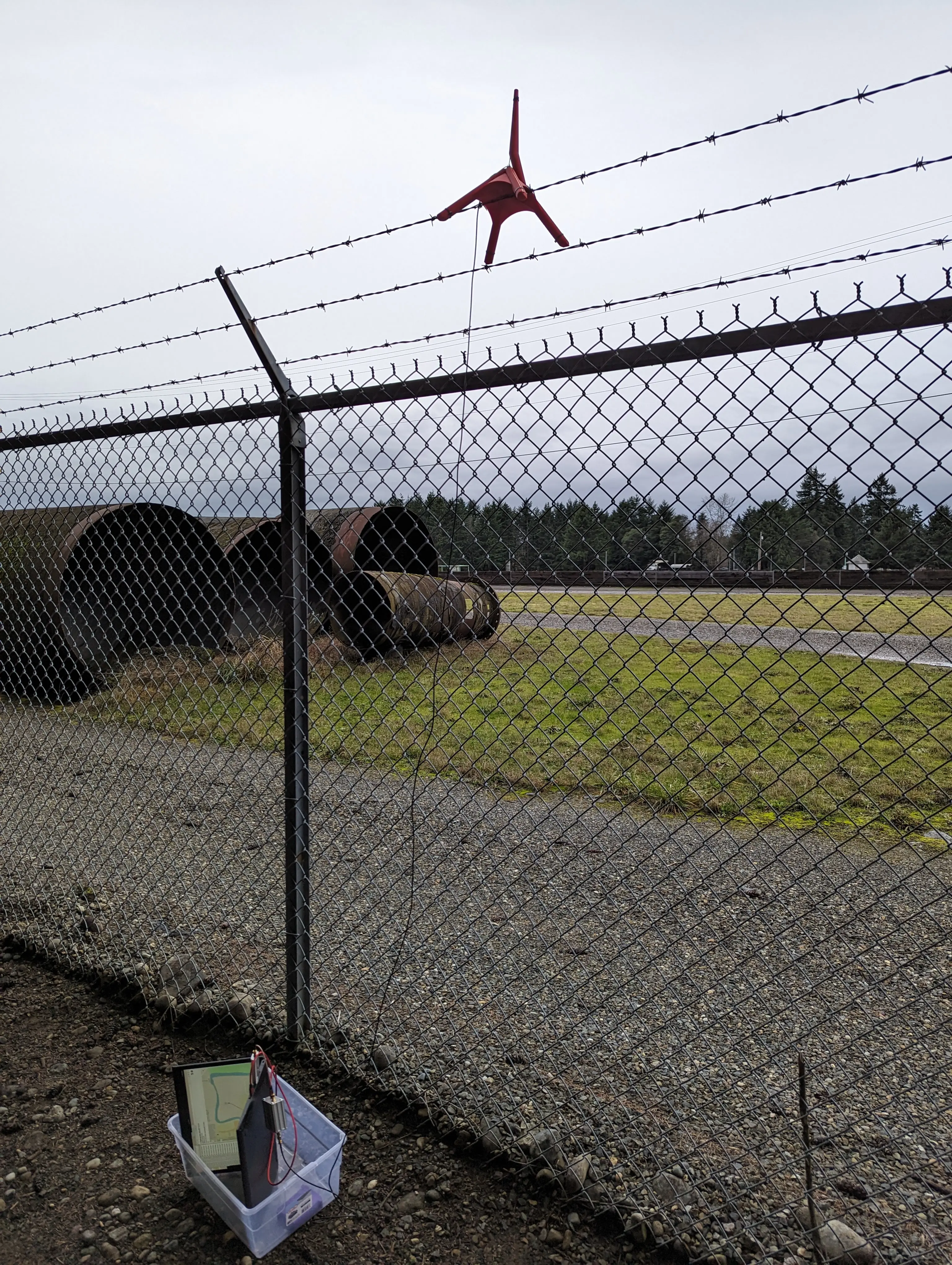
My email notifier told us that bonus sondes were being launched all weekend. We started out looking at the projected flight path for Sunday morning’s 10AM (Pacific Time) sonde, V3140090. It was first heard by N0NHJ’s receiver in Tacoma at about 3,400 feet. SondeHub projected the takeoff location around Ridgecrest Elementary School in Puyallup, one of the possible launch sites that folks on the discussion group had considered … maybe it’s a school project? We drove to Puyallup just before the anticipated 1PM launch. First we drove a lap around the school, seeing no activity. Then, we set up our portable receiver—a Linux laptop with mobile hotspot running radiosonde_auto_rx, an RTL SDR dongle, a filter+LNA tuned for 403MHz, and a homemade monopole antenna with a 3D printed frame that we put on the roof of the car.

A couple of minutes later, sonde V3310159 came over the horizon and started giving us good strong pings indicating a position to our south! We first started picking it up at about 1,700’; by the time it passed over us at the school it was climbing through 2,300’. We were a little disappointed our initial guess at the launch site had been wrong, but there was a clear next step. Because we’d started to hear the sonde at a much lower altitude than the fixed receive sites had, SondeHub gave us a better launch estimate: the north end of the nearby McMillin Reservoir, about a mile south of us.
We packed up, drove to the reservoir’s front entrance, and discovered to our disappointment that the entire facility is surrounded by high fences and razor wire. The whole site says “go away.” Near the entrance road there was a small parking lot and customer service building. We parked and peered beyond the fence, but didn’t see anything that looked like a NOAA launch site, such as the typical a domed building or hydrogen storage farm. We did, however, see a large monopole antenna on top of a rusty 20-foot tower a few hundred feet away. Might that be a sonde receiver? It might! It was hard to judge its size from so far away but it did seem to be much larger than something tuned for 400 MHz.

We got back into the car and drove around the residential areas on the reservoir’s perimeter. After a couple of miles, this brought us to another elementary school on the south edge of the reservoir. We walked into their back yard and found a small berm that overlooked the site but again, everything was too far away to see anything clearly.
As our circumnavigation continued, we made a fortuitous discovery: a public hiking path on the east side of the reservoir, right along the fence line! We walked a mile up the the trail, finally finding a good spot with a beautiful view of most of the facility. We still saw nothing that looked like a launch site, but we were willing to wait a couple hours for the 4PM sonde to be launched. We drove to a nearby restaurant to get a late lunch; I pulled my laptop out and looked at the history of the last dozen or so bonus sondes launched from the area. To get the quickest possible reception, we didn’t want to lose the minute that it takes for auto_rx to cycle through the entire band scanning for signals. The history showed that sondes in the area all use 405.3, 405.5, and 405.7 MHz so we reconfigured auto_rx to just scan those three frequencies.
Finally, just before 4PM we returned to the hiking trail, set up the receiver, and—boom! We instantly heard pings from sonde V3130545 while it was still on the ground, giving us its exact position! It was coming through loud and clear with an SNR of better than 40dB. The position reported was on the west side of the reservoir (we were on the east side), south and west of us. We quickly picked up our gear and moved south until we were due east of it, looked west through the fence and across the water, and there we saw a man in a shed inflating a giant balloon! Success!
We stayed to watch the launch, waited until the other Seattle-area stations started to pick up the signal, then finally packed up and went home. Mystery solved!
Epilogue
When we told this story on one of the Facebook groups devoted to finding sondes, Mark Jessop, the administrator of Sondehub, added the launch site to Sondehub’s map! Hopefully, the launch site will no longer be a mystery to future hunters.
Jon and I reached out to the reservoir administration and NOAA to learn who was launching the sondes and why. We never heard back, but some Internet sleuthing provided the answer when I learned about FIRO, a research program for “Forecast Informed Reservoir Operations”—that is, optimizing the management of reservoirs on the U.S. West Coast by improving skill in forecasting rain and floods. They explain that “the key to accurately predicting precipitation and flooding is linked to an understanding of the dominant rainfall producing mechanism, atmospheric rivers,” including a radiosonde sensing program that launches sondes from 7 sites on the West Coast, including in Tacoma. “The radiosondes are launched every three hours during storm conditions,” they say, matching our observations!
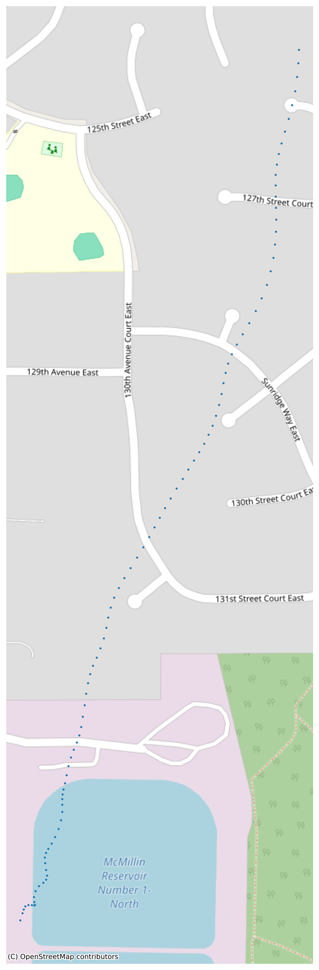
Delightfully, this research program makes all their data public. Given the facts above, there seemed little doubt that this program was responsible for the sondes we saw. But just to prove it absolutely, I downloaded the research program’s data log from the same time as the launch we’d witnessed. I plotted the first couple hundred lat/lon points from that log and, sure enough, the map I drew showed the sonde starting from exactly the spot we’d seen in the reservoir. Now the mystery has really been solved!